Published On Jan 4, 2023
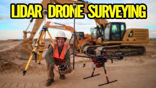
Want to improve the accuracy of your drone-captured images? Check out our video on using ground control points (GCPs) in photogrammetry! We'll be discussing how GCPs can be used with RTK technology to get the best results and sharing tips on using them with drones like the DJI Mavic 3 Enterprise and Autel Evo. GCPs are a must-have tool for anyone working with drone photogrammetry, so don't miss out on this valuable information!
Drone Photogrammetry Workshop: https://www.pilotbyte.com/photogramme...
Drone Photogrammetry Course: https://www.pilotbyte.com/course/dron...
Equipment Used:
Autel Evo 2 Pro: https://amzn.to/3vTTEI5
Ground Control Point Tags: https://amzn.to/3i8rm9e
DJI Mavic 3 E: https://www.dji.com/mavic-3-enterprise
—
► Join us on Pilot Byte! Our platform provides current and aspiring drone operators with information and resources to promote growth and development in the drone industry: https://www.pilotbyte.com
► Subscribe to my channel here: / dylangorman
—
My Camera Equipment!
Canon C70: https://amzn.to/3WI6nt7
Canon R5: https://amzn.to/36YsAP1
Canon RF 15-35 2.8L: https://amzn.to/3WYITQF
Canon 24-70 2.8L: https://amzn.to/2S2KVCK
Rode Microphone: https://amzn.to/3pfokiM
Drone: https://amzn.to/3x9GHLW
__
Follow me online!
LinkedIn: / dylan-g-099961101
Instagram: / dylang_1
—
Chapters
00:00 Intro
01:00 What are Ground Control Points?
02:05 How to set GCP's
03:41 Equipment needed
04:50 Data capture
05:15 Drone Photogrammetry Workshops
06:04 Data processing
08:51 GCP target alignment
09:50 Viewing the accuracy
13:24 RTK vs GCP
13:58 Drone Photogrammetry Online Course
14:45 Outro