Published On Mar 4, 2019
Visit: https://www.SteelCityFlightAcademy.com | Drone Training Anywhere In The United States
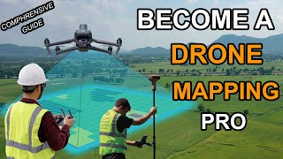
In this video we show how portable ground control Points increase accuracy for drone mapping data acquistion and reduces onsite time and overall project costs. We demonstrate how to use the Propeller Aeropoint versions specifically.
-Steel City Drones offers both online mapping classes as well as in person classes.
-We are the only drone school that will train your staff at your facility to keep training costs low.
----------------------------------------------
**Steel City Drones Flight Academy offers complete drone training services anywhere in the United States.
-We offer training services for all DJI platforms including the DJI M200, Inspire, Mavic, and Phantom series.
-We offer drone-introduction classes, advanced drone flying, commercial drone applications classes, cell tower inspections with drones, and precision agriculture using drones -such as golf course management.
-If you are ready to take your drone capability to the next level, visit our website today!
Visit: https://www.SteelCityFlightAcademy.com