Published On Premiered Jan 5, 2021
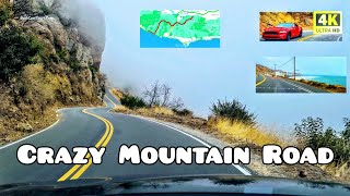
Driving from San Fernando to Oxnard 4K
California Scenic drive from the city of san fernando to tge city of Oxnard California, USA
This driving tour takes you from the heart of san fernando Valley, city of san fernando to the city of Oxnard on the California Freeway 118, California route 23 and Pacific Coast Highway
San Fernando is a city in the San Fernando Valley region of Los Angeles County, California, in the Los Angeles metropolitan area.
It is bordered on all sides by the City of Los Angeles.
As of the 2010 census the population of San Fernando was 23,645.
Oxnard is a city in Ventura County, California, United States. On California's South Coast, it is the most populous city in Ventura County and the 22nd most populous city in California.
Incorporated in 1903, Oxnard lies approximately 60 miles (97 km) west of downtown Los Angeles and is part of the larger Greater Los Angeles area.
California State Route 118
Language
Download PDF
Watch
Edit
State Route 118 (SR 118) is a state highway in the U.S. state of California that runs west to east through Ventura and Los Angeles counties. It travels from State Route 126 at the eastern edge of Ventura immediately northwest of Saticoy, then through Saticoy, in Ventura County east to Interstate 210 near Lake View Terrace in Los Angeles. SR 118 crosses the Santa Susana Pass and the northern rim of the San Fernando Valley along its route.
California State Route 23
Language
Download PDF
Watch
Edit
"CA 23" redirects here. For the congressional district, see California's 23rd congressional district.
State Route 23 (SR 23) is a state highway in the U.S. state of California that connects the Pacific coast and the Santa Monica Mountains to the Conejo and Santa Clara River valleys. It runs from Pacific Coast Highway (State Route 1) in Malibu in Los Angeles County to Ventura Street (State Route 126) in Fillmore in Ventura County.
Pacific Coast Highway
SR 1 crosses the county line and continue through the Ventura County portion of the Malibu coast through Leo Carrillo State Park and Point Mugu State Park.
After passing through a notch in the promontory that marks Point Mugu, the western end of the Santa Monica Mountains, and the beginning of the Oxnard Plain.
The road cut left a very large rock formation at the tip of the point that is called the Mugu Rock. At that point, PCH leaves the coast and heads north, and then northwest as a freeway along the northeastern boundary of Naval Base Ventura County Point Mugu for several miles to an interchange at Rice Avenue, Pleasant Valley Road, and Oxnard Boulevard in Oxnard.
The reconstructed interchange at Rice Avenue and Pleasant Valley Road channels traffic north on the surface street, Rice Avenue, towards the interchange with US 101.
The historic route along Oxnard Boulevard was relinquished in 2014. Truck traffic to and from the Port of Hueneme also uses this designated route at the Rice Avenue/Hueneme Road connector to connect with Route 101 at the Rice Avenue Interchange.
Dash Cam Tours
#SanFernando #LosAngeles #Oxnard
December, 2020
©️ Dashcamtours.com
Check out my second channel with scenic walking tours:
/ povwalks
Follow on Twitter:
https://twitter.com/DashCamToursDot?s=09