Published On Sep 5, 2019
A pilot project in collaboration with Conexus Baltic Grid, to verify the applicability of #airborne Ground Penetrating Radars (#GPR) to locate underground gas pipes.
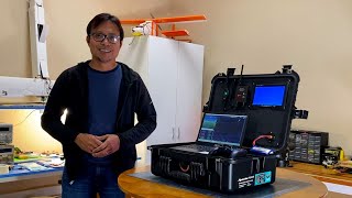
For the subsurface surveys, 124 MHz and 500 MHz GPR antennas were used integrated with a DJI M600 #drone.
The full integration is ensured by adding the onboard UgCS data logger to the system, which automatically on drone take-off starts the logging of GPR data and geotagging it with GPS positions.
The system is also enriched with a laser altimeter, to ensure the flight in True Terrain Following mode - mimicking the surface relief to ensure the #GPR is flown as low as possible.
Drone's flight is planned and managed using the full functionality of ground control software #UgCS.
Results: The 700mm steel pipe is clearly detectable in 1.5meter depth from altitude up to 7meters using 500 MHz #GPR system in sandy soil (typical for Latvia). Acquired and processed data samples can be downloaded on https://files.ugcs.com/s/pjwttKyrP3E2Xed.
Discover GPR+drone integrated system: https://industrial.ugcs.com
JSC „Conexus Baltic Grid” is a unified natural gas transmission and storage operator in Latvia.
Discover: http://www.conexus.lv/en
For gas infrastructure inspections the drone integrated system can be equipped with a laser methane (CH4) detector. Discover: • Solution for methane leak detection w...