Published On Mar 31, 2023
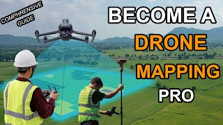
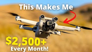
Use your drone to perform drone mapping and photogrammetry, create maps, point clouds and 3D models for FREE with this MapsMadeEasy tutorial! It's cloud based, so you don't need a powerful computer either.
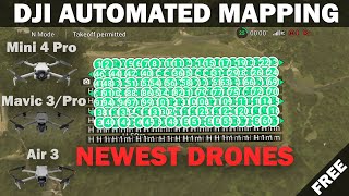
Maps Made Easy makes it so simple for anyone who owns a drone or UAV to use photogrammetry and create a map for free and then share it online! But not just DJI drones, their cloud processing app will process any drone images.
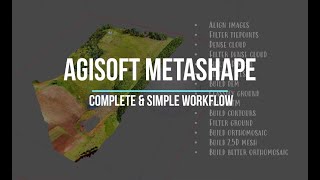
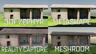
See how it compares to commercial offerings such as Agisoft Metashape and Pix4D.
Autel drones are supported as well in their flying app. It's amazing what they offer free of charge.
Map Pilot Pro (https://dronesmadeeasy.com/map-pilot) supports all of these drones:
Mini 2
Air 2
Air 2S
Air
Mavic 3 Enterprise (on M3E remote)
Mavic 3 Multispectral (on M3M remote)
Mavic 2 (Pro, Zoom, and Enterprise - No SMART CONTROLLER support)
Mavic 2 Enterprise Advanced
Mavic Pro
Phantom 4
Phantom 4 Pro * (v2 included)
Phantom 4 Advanced
Phantom 4 RTK
Phantom 3 Professional
Phantom 3 Advanced
Phantom 3 Standard
Inspire 1
Inspire 1 Pro
Inspire 2
M30 (on RC Pro Plus remote)
M30T(on RC Pro Plus remote)
Matrice 100 (M100)
Matrice 200 (M200, including V2)
Matrice 210 (M210, including V2)
Matrice 210 RTK (M210RTK)
Matrice 600 (M600)
Matrice 600P (M600P)
Autel EVOII ( no "V2" support)
This is not a sponsored video
How you can support my work
-------------------------------------------------
Please consider buying me a coffee:
https://www.buymeacoffee.com/geospati...
Hire me on Upwork:
https://www.upwork.com/freelancers/~0...
00:00 - Looking for a Free Alternative?
00:17 - Map Pilot Pro Image Capture
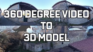
01:20 - Maps Made Easy Data Processing
09:40 - Global Mapper Additional Processing