Published On Jun 16, 2022
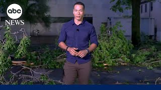
On June 15th, 2022, a Moderate Risk (level 4 of 5) for severe weather was issued over most of southern Wisconsin, which included a 15% hatched risk for significant tornadoes. Storms were slow to organize at first, however 2 dominant supercells eventually evolved. The first supercell I was on produced a large rain-wrapped tornado near Tomah, WI (rated EF-2), which I did not see due to keeping a safe distance from the high-precipitation storm in terrible chasing terrain. The second supercell I chased was beginning to get swallowed up by the developing squall line. As I was trying to race to get ahead of the storms which were rapidly increasing in forward speed, the former supercell dropped a QLCS tornado right behind me. I pulled over and got some footage of the intense RFD winds followed by the outer edge of the tornado's winds. This tornado was rated EF-1. Some quarter-sized hail also fell with this storm. Other intercepts in this video include severe/tornado warned storms over Horicon Marsh National Wildlife Refuge, as well as a severe portion of the mature squall line as it passed over home, causing some tree damage (not seen on video).
My Instagram: / jm.smith_
Thanks for watching!