Published On Feb 27, 2018
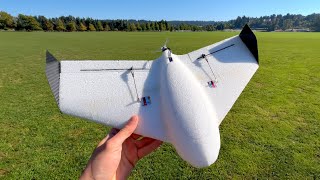
Meet the WingtraOne VTOL drone. The safest and most accurate vertical take-off and landing (VTOL) drone for mapping and surveying.
***
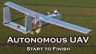
How the WingtraOne VTOL drone works
https://wingtra.com/why-wingtra/vtol-...
WingtraOne
https://wingtra.com/mapping-drone-win...
Surveying with drones
https://wingtra.com/drone-mapping-app...
***
WingtraOne combines vertical takeoff and landing with long-range flights. The vertical landings on spot allow you to operate the WingtraOne everywhere, even in confined spaces and on rocky grounds. In combination with the efficiency and forward flight of a fixed-wing drone, you now can accomplish large surveying flight missions that you weren't able to do up until today.
WingtraOne carries the best-in-class mapping cameras for your work. They can be swapped in no time on the field. With the Sony RX1RII Wingtra offers a 42 megapixel full-frame camera with an ultra low distortion lens that enables the unprecedented combination of image resolution and flight coverage. WingtraOne sets the new benchmark for surveying great accuracy. Eliminating ground control points from your workflow by activating the state-of-the-art PPK surveyors obtain a centimeter accuracy and superior reconstruction results.
A new level of simplicity is brought to you by Wingtra's surveying mission planning and in-flight monitoring software WingtraPilot. Great features make planning easy and ensure mission success. WingtraOne increases operation safety. By the push of a button WingtraOne is fully autonomous from takeoff and landing. It keeps the operator in a safe distance at all times
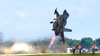
After completing the survey WingtraOne gently touches the ground eliminating wear and tear. Don't worry about broken wings and damaged cameras through rough belly landings.
The WingtraOne is the trusted VTOL drone that exceeds the highest expectations of geospatial professionals around the world. It is designed to be integrated in every workflow. Start taking better decisions based on accurate aerial data with the WingtraOne today.
WingtraOne data outcomes are compatible with major photogrammetry software such as Pix4DMapper, 3DR Site Scan, DroneDeploy, Delair Aerial Intelligence, Bentley, Propeller, SimActive Correlator3D, Agisoft Metashape and many more.
Latest tests in the USA and Switzerland prove that the VTOL drone WingtraOne can achieve 1 cm (0.4 in) absolute accuracy. Read the white paper for more information: https://wingtra.com/drone-survey-accu...
***
Wingtra develops, produces and commercializes professional surveying drones that carry the best in class sensors for survey-grade aerial data collection. The technologically superior VTOL drone is used by geospatial professionals in applications that range from surveying and mining to construction and wildlife monitoring.
Wingtra was founded in 2016 as a spin-off from Prof. Dr. Roland Siegwart’s Autonomous Systems Lab, at ETH Zurich in Switzerland.
Website: https://wingtra.com/
Facebook: / wingtraone
LinkedIn: / 9490361
Twitter: / wingtra
***