Published On May 4, 2023
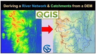
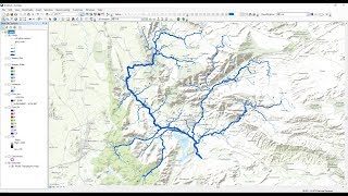
In this tutorial, you will learn how to delineate catchments and derive the associated river networks, with the help of a digital elevation model, which is also commonly known as a DEM, using ArcGIS Pro.
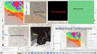
Watershed delineation is a crucial process in hydrological analysis, aiming to identify the boundaries of drainage basins based on the topography of the landscape. ArcGIS software provides powerful tools to perform this task effectively. By utilizing a digital elevation model (DEM), which represents the terrain's elevation values, ArcGIS enables the extraction of essential information for watershed delineation. The process typically involves using the hydrological analysis tools available in ArcGIS, such as "Fill," which removes depressions, and "Flow Direction," which determines the flow path of water across the terrain. The subsequent step involves computing the "Flow Accumulation," which quantifies the accumulated flow at each pixel, aiding in the identification of stream networks and catchment areas. Finally, the "Watershed" tool allows for the delineation of watershed boundaries by assigning each cell to its corresponding drainage basin. Through these integrated functionalities, ArcGIS facilitates the efficient and accurate delineation of watersheds, enabling researchers, planners, and environmental professionals to gain valuable insights into hydrological systems and make informed decisions for water resource management.
Interested in more ArcGIS Pro tutorial videos? head over to our special 'ArcGIS Pro Tutorials' playlist - • ArcGIS Pro Tutorials