Published On May 16, 2023
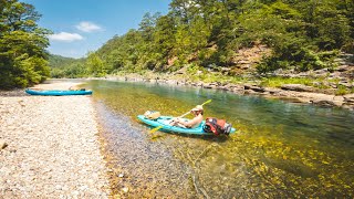
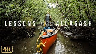
This is a hiking and packrafting route revolved around the Dumoine Tote Road Trail, and the Lower Dumoine River, from Grand Chute to the Ottawa River. This route should be done during the high water season, spring run off as at low water, the paddling can be rather flat and tiresome in a packraft. While the flood levels on the Dumoine River create some challenges on the river, most sections have a safe line through them, as you can see in the video. The high water levels will also create challenges when hiking on the trail, such as wash outs, but that is the price to pay in order to run the river at this level. For logistics, I parked at Stonecliffe behind the municipal building, hiked to the boat launch in town, paddled across the Ottawa river to the mouth of the Dumoine, hiked the Dumoine Tote Road Trail to Grand Chute, and the paddled all the way back down the river and across the Ottawa River to my car.
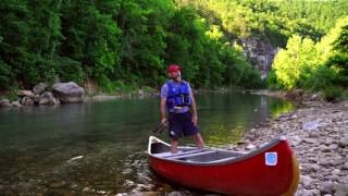
At these levels, there are many sections of continuous rapids, some long sections lead to significant drops and ledges, ranging anywhere from class 1 to 5. Be sure to scout every single rapid before running, upriver it can look very mellow but the reality will be different. Also ensure that if water levels have changed, to re-scout, as the lines change dramatically based on a foot or so of flood, which is what I experienced on this trip.
Buy your Suluk 46 Ultralight Backcountry Gear here: https://www.suluk46.com
Follow us on Instagram: / suluk46
Follow us on Facebook: / suluk46
Be sure to check out our other videos and subscribe!